How the mile travelled to India: Part 1
How did the standard mile travel to India? And why was it adopted by British colonial rulers as a linear measure in India in the late 1700s and 1800s?
One clue lies in this rather innocuous object in our collections: the waywiser, also called a perambulator (Fig. 1). Trundled along villages and towns, this device translated the rotations of its large wheel into a measure of distance which was read off the face of its dial.
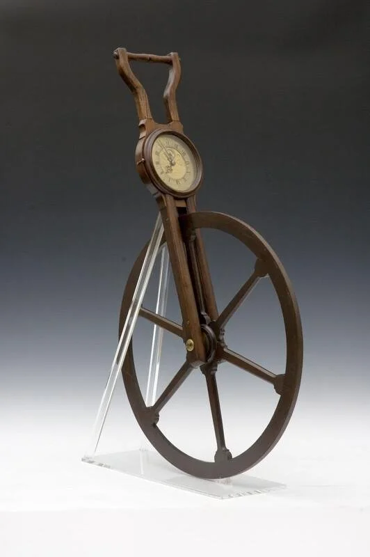
Figure 1: Waywiser, by Thomas Wright and William Wyeth, London, 1740/1. HSM Inventory No. 39818.
The idea behind the waywiser dates back to antiquity. Marcus Vitruvius Pollio, the military engineer and architect of the Caesars, gave detailed descriptions of a similar but elaborate instrument (the ‘odometer’) in first century BCE, a design unsuccessfully reconstructed by the Renaissance-era Italian polymath Leonardo da Vinci. By the late 1600s, the waywiser was widely used in England. While a version of the instrument was attached to a horse-drawn coach (an invention attributed to William Backhouse, the mystic mentor of the famous English antiquary and Royalist politician, Elias Ashmole, Fig. 2), it was more commonly operated by two persons (or ‘perambulators’), one charged with the waywiser’s bearing aided by a compass, the other tasked with cleaning the rim of the wheel. This descendant of the ancient odometer now goes by the ‘Surveyor’s wheel’.
In part 1 of this blog, I will trace the history of the waywiser’s use in England and Wales. This is a story of the unlikely role played by the postal service, new roads, and a Scottish dance master in the reign of Charles II in establishing the English standard mile and its measuring instrument, the waywiser. In Part 2, we will follow the waywiser’s journey through the roads and routes of colonial surveyors in India in the late 1700s and 1800s as British officials, once again, adapted this English measure in unfamiliar territory.
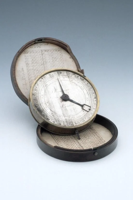
Figure 2: Carriage Waywiser by Ramsden, London, Late 18th Century. The instrument is clipped to a carriage by three key-hole slots in the back; the drive is to a tapered, square-sectioned shaft at the bottom. HSM Inventory Number 34053.
One mile too many
The waywiser’s story is deeply entwined with the standard mile. But just how did the mile come to be standardised?
In England, clerks educated in Latin maintained the Roman mile of 1000 passus (paces) as a liner measure, and in the late medieval period this mile came to be subdivided into furlongs (a word of Old English origin, literally a ‘furrow long’ or the length of an open field which oxen could plough without resting). The mile of 8 furlong (or 1,760 yards) was increasingly adopted in and around Winchester and London, but it was the Act of 1592 passed to limit new buildings near London and Westminster which transformed this into an official measure.
But this mile was not statutory, and it was the establishment of the Post Office during the reign of James I that proved pivotal in the wide adoption of the standard mile, and with it, its measuring instrument, the waywiser. The standard mile of 1,760 yards or 8 furlongs helped fix the rates (or ‘mileage’) for horse hire for postal carriages from London and with it, the standardisation of wages for postal workers. But the standard mile in this period jostled with older measures which were notoriously variable across localities: for example, a 3,208-yard mile in Northamptonshire co-existed with the 1,689-yard mile in Lancashire. Indeed, the idiom ‘a country mile’ expressed a widely held belief of the fickle rural English mile.
A tool of the counter-revolution: The standard mile as a national measure
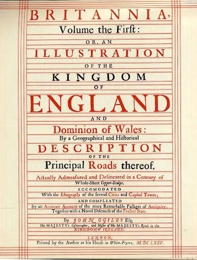
Figure 3: Title page of John Ogilby’s Britannia which sought the highest perfection in Geographical knowledge by using the method of ‘Actual Dimensuration’ or measurement using a perambulator.
John Ogilby’s Britannia or Itinerarium Angliæ (1675) marked an important moment in the acceptance of the standard mile as a national unit in England and Wales (Fig. 3).
Raised in poverty in Scotland, Ogilby wore many hats over his long career. He was a dance master of the courtly masque, a playwright, translator (notably of Virgil’s Aeneid and Homer’s Iliad), director of public spectacles (choreographing the coronation of Charles II), poet, and towards the end of his life, Cosmographer Royal. It was as Cosmographer in the 1670s that Ogilby set upon his most ambitious project yet: a topographic depiction of the nation’s roads based on ‘dimensuration’ or precision measurement, the first such road-atlas of any European country.
In 1675 Ogilby and his many helpers set upon their journey to measure roads using what he called a ‘way-wiser’ (or road-knower), measuring 16.5 feet in circumference, trundled over bridges, bogs, marshes, and valleys of England and Wales. The resulting volume, Britannia, was a compilation of 73 roads in beautiful engraved strip maps detailing rivers, hills and various habitations (Fig. 4), representing 1 inch to a ‘standard’ mile of the journey of the waywiser, and totalling an astounding 26,000 miles.
But the way-wiser was no idle instrument in Ogilby’s mind, and the instrument received pride of place in Britannia’s front piece (Fig. 5).
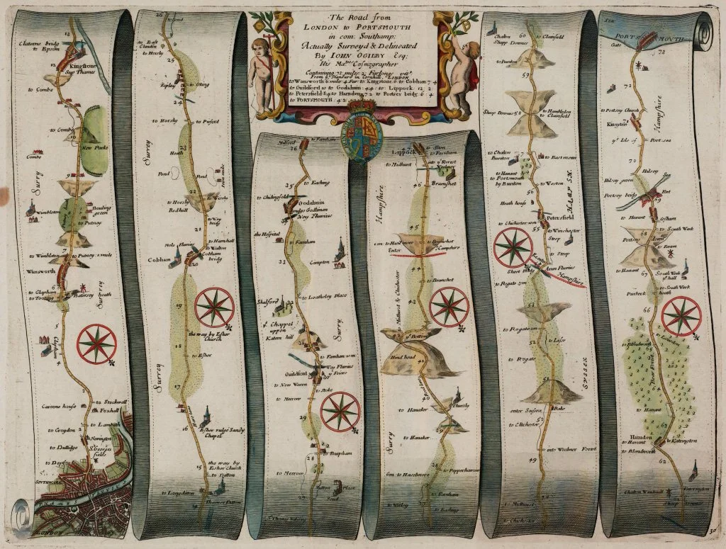
Figure 4: Strip-maps of the road from London to Portsmouth in Ogliby’s Britannia. These were engraved on copper plates and represent 1 inch to the standard mile.
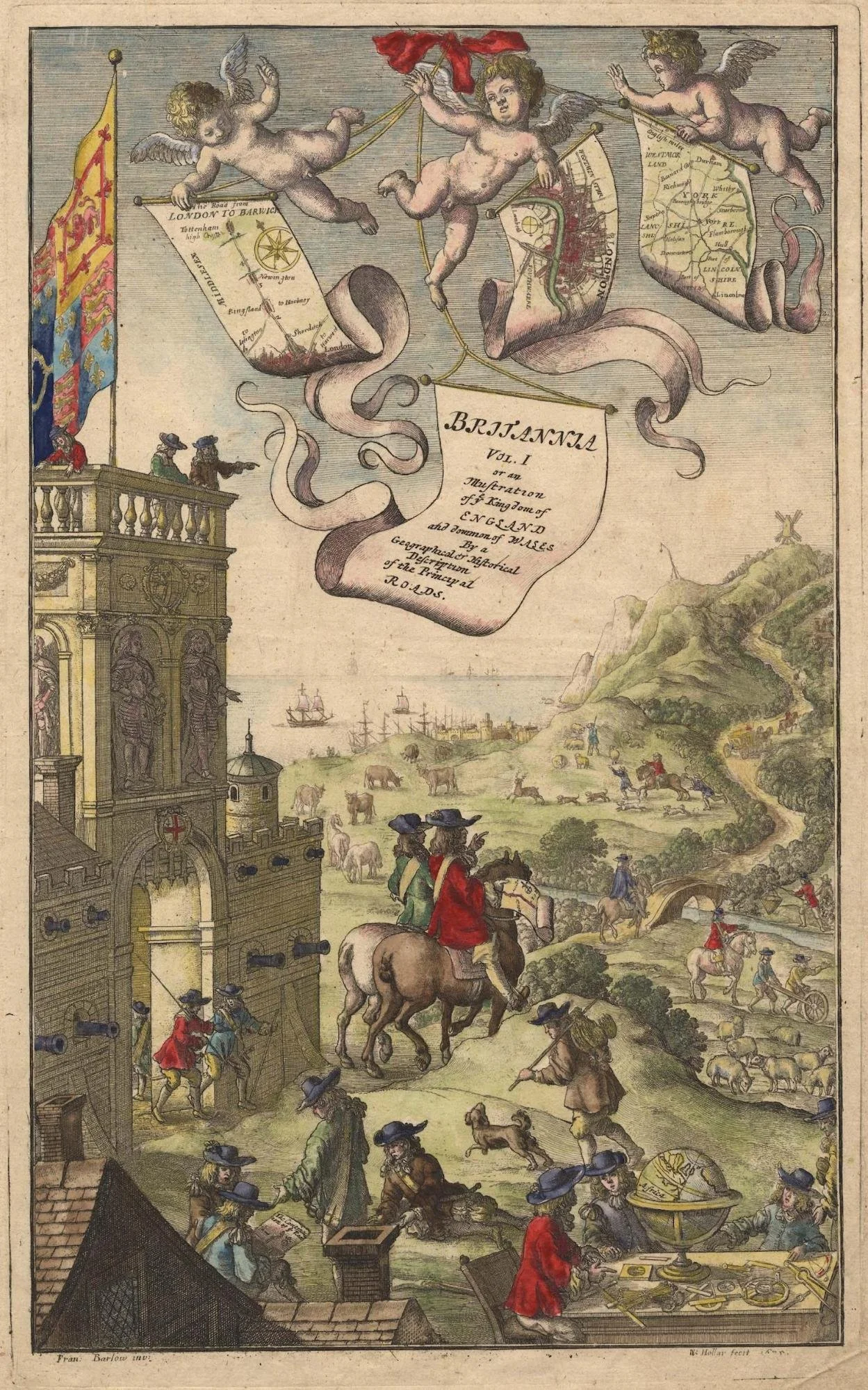
Figure 5: The frontispiece in Ogilby's Britannia. A surveyor and assistants are shown at the lower right. This illustration was etched by the Czech artist Wenceslaus Hollar.
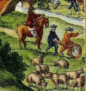
‘Practical mathematics’ and mathematical instruments had come to acquire a new meaning by Ogilby’s lifetime, as surveying techniques pioneered by Flemish mathematicians inspired Britain’s first national atlases, including Christopher Saxton’s influential county maps published in 1579. By using the waywiser and the ‘standard mile’ as measure, Ogilby sought to replace traditional measurements with the new quest for precision in surveying, transforming what he called ‘guess-plots’, referring to old maps, into a new cartography. As he claimed in the preface to his book, this was nothing short of the elevation of Geography to a more ‘transcendent pitch’, using the method of ‘Actual demensuration’. For this enterprise, Ogilby considered the waywiser a most reliable instrument, capable of measuring small deviations, indeed even more so than the chain then in use (Fig. 6).
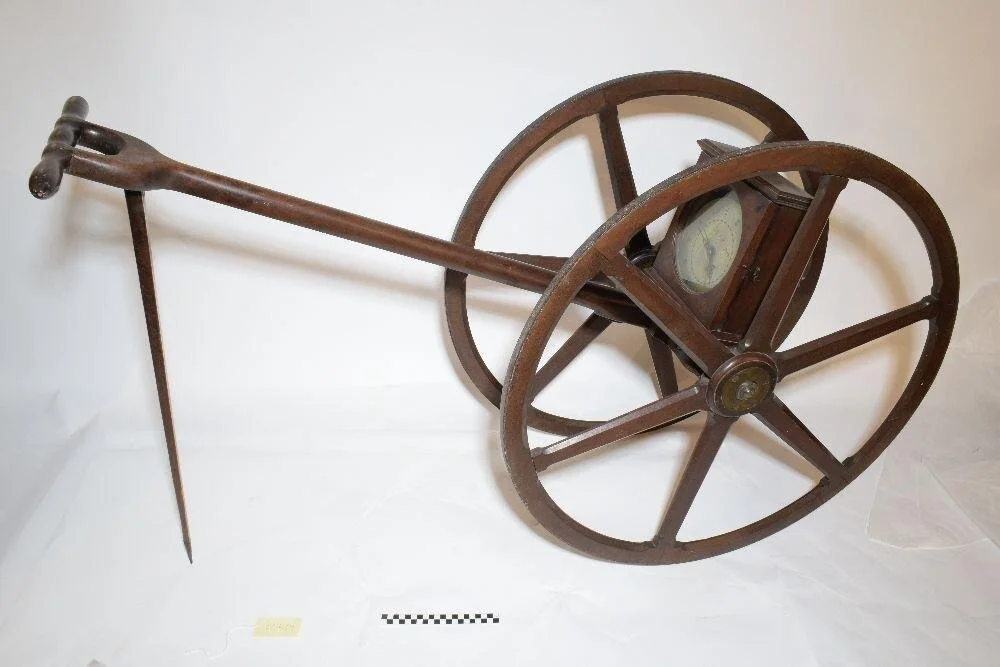
Figure 6: Waywiser, by Benjamin Martin, London, c. 1770. An unusual two wheeled waywiser, that records yards, poles, chains, furlongs, and miles up to 12 miles. HSM Inventory number 80406.
But Britannia did something more: it tied this new Geography to the sovereign’s view of the world, at a time when sovereign authority had come under sustained attack following the Civil War and the Commonwealth. Ogilby’s Britannia was no birds-eye view of the land, but a world seen through the roads emanating from London, and as a result, it left out those places (such as Liverpool) and features not found along the many arteries of the sovereign's kingdom. By fixing the 8-furlong mile as its measure, Britannia introduced a new national standard of land measure, drawing together the laws that governed nature and men.
Ogilby’s Britannia inspired many more men to follow in his footsteps. The following century saw revised versions of his road atlas and the use of the waywiser (Fig. 7 and 8)
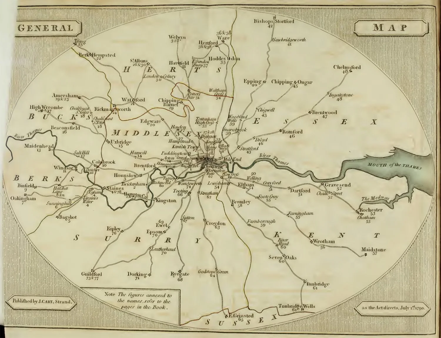
Figure 7: All roads lead to London. John Cary’s Survey of the High Roads from London (1790) built on Ogilby’s Britannia. Cary was appointed Surveyor of the Roads to the General Post Office in 1794 and was the leading map-publisher of his time.
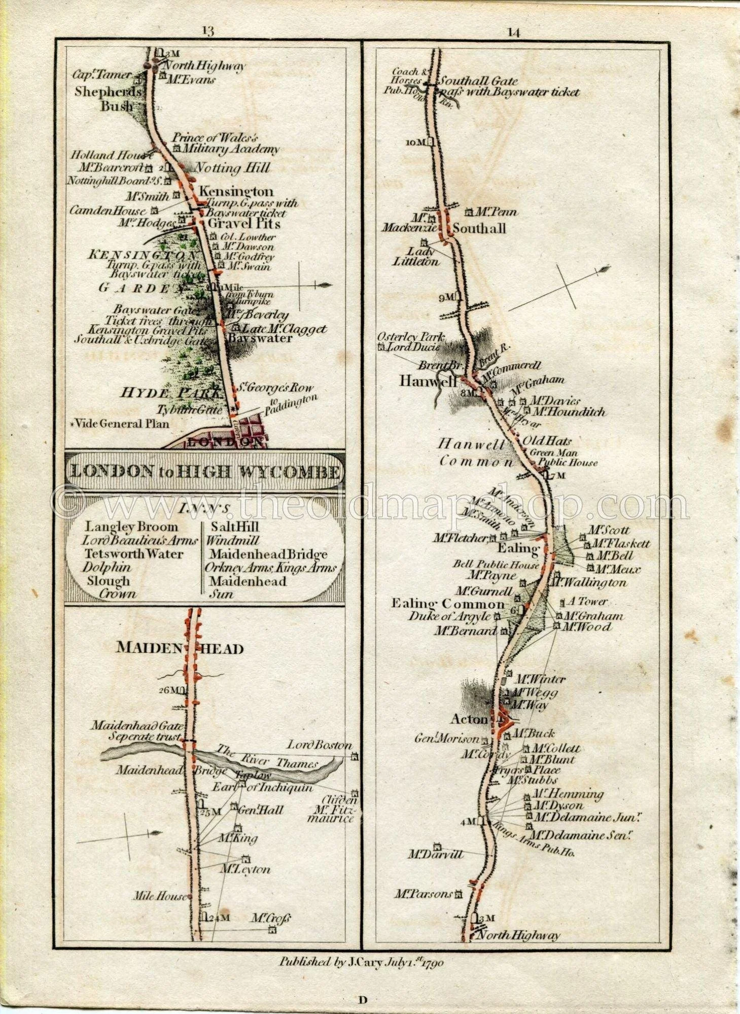
Figure 8: Strip-map from John Cary’s Survey of the High Roads from London (1790).
However, old linear measures persisted. The Turnpike Acts of the 1700s mandated 8-furlong milestones on its improved roads, but it was not until the 1824 Act of Parliament for ‘ascertaining and establishing Uniformity of Weights and Measures’, that the mile came to be affixed to 1,760 imperial standard yards by legal statute in Britain (Fig. 9). Even so, it was a long while before what Ogilby called the ‘vulgar computation’ in old miles died out.
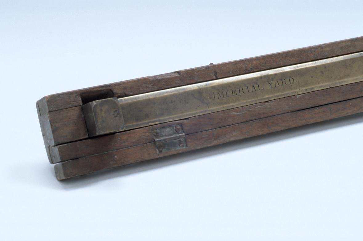
Figure 9: Standard Imperial Yard with Case, by De Grave, London, 1837. HSM inventory Number 17582.
References
John Ogilby, Britannia Volume the First Or, An Illustration of the Kingdom of England and Dominion of Wales: By a Geographical and Historical Description of the Principal Roads thereof (London, 1675).
Herbert George Fordham, ‘JOHN OGILBY (1600–1676) His Britannia, and the British Itineraries of the eighteenth century’, The Library, S4-VI (1925), 157-178.
Alan Ereira, The Nine Lives of John Ogilby: Britain's Master Mapmaker and His Secrets (Gerald Duckworth & Co, 2016).
Charles Close, ‘The Old English Mile’, The Geographical Journal, Vol. 76, No. 4 (1930), pp. 338-342.
J. B. P. Karslake, ‘Further Notes on the Old English Mile’, The Geographical Journal, Vol. 77, No. 4 (1931), pp. 358-360.
Links to our Collections
Waywiser, by Thomas Wright and William Wyeth, London, 1740/1. HSM Inventory No. 39818
Carriage Waywiser by Ramsden, London, Late 18th Century. HSM Inventory Number 34053
Waywiser, by Benjamin Martin, London, c. 1770. HSM Inventory number 80406
Standard Imperial Yard with Case, by De Grave, London, 1837. HSM inventory Number 17582
